A morning run through 10,000 years of history in the Montagne Noire
Why do I love the Lauragais and the Montagne Noire? Where else can you find a heritage trail that offers so much in such a short distance, not to mention seeing France’s most beautiful tree naked in the sunshine? ‘Short’ is, of course, a subjective measure, and some adventurers may view 21 km with 600 metres of climbing as a long and challenging walk. But you can cut that down to around 14 km if you skip the orientation table, and the reward is certainly worth the effort!
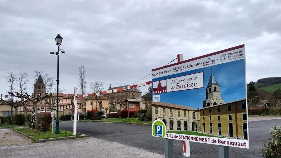
08.15 – It’s spitting with rain but I’m convinced it won’t last. The high wall of a park provides some shelter; it belongs to the Abbey of Sorèze, founded in 754, turned into a Royal Military School under Louis XVI, and now home to the Dom Robert tapestry museum.
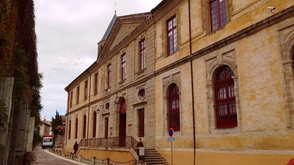
The Abbey of Sorèze, founded in 754
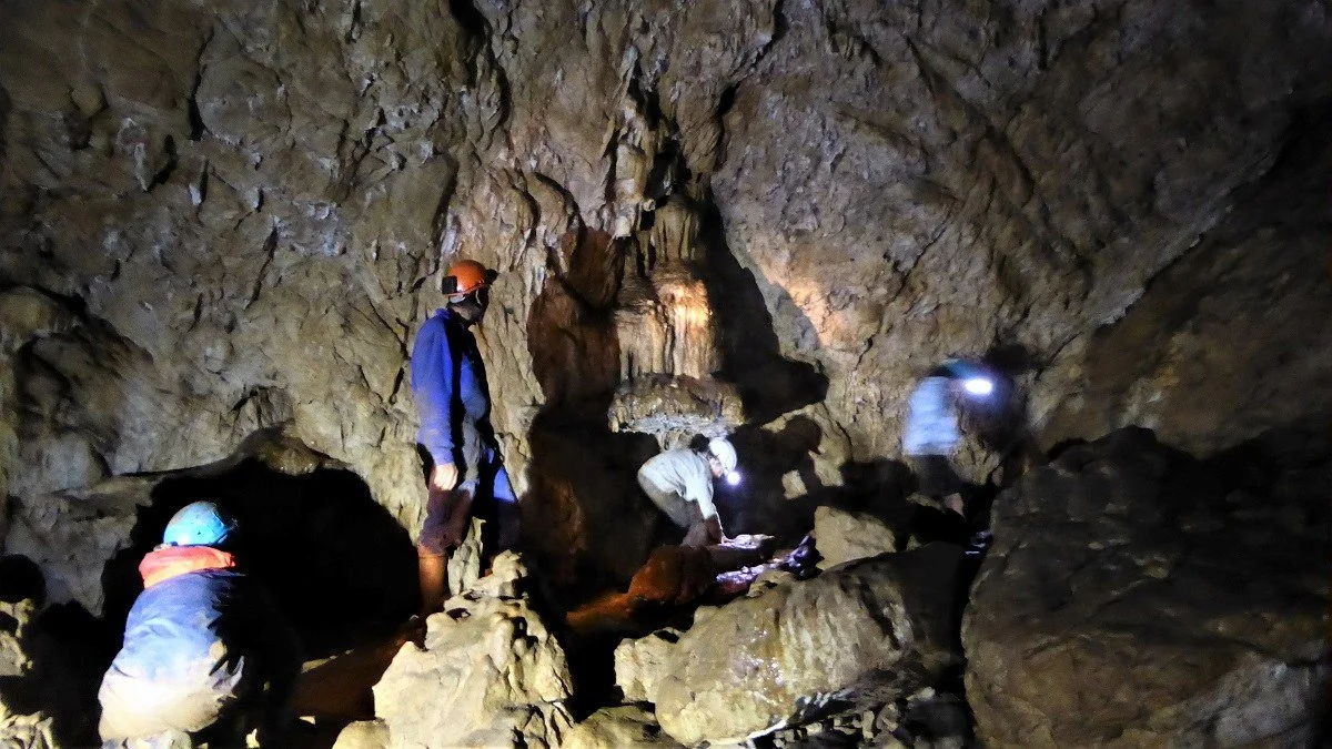
The Grotte de Calel, mined for iron in the 11th century CE.
08.45 – It’s windy on the limestone plateau above Sorèze. Perhaps I should take shelter in one of the many caves beneath my feet, such as the Grotte de Calel where my archaeology-speleology friends have found evidence of iron ore mining dating from the 11th century (this is a photo I took on another occasion!)
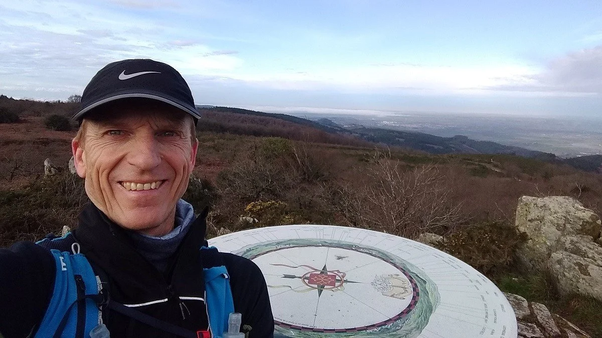
Montalric orientation table (789 metres above sea level).
09.23 – I am on top of the world, looking out on the Lauragais and the Pyrenees from the Montalric orientation table (789 metres).
09.36 – It’s a stony, gently-descending path through the forest that takes me past the forge and workshops of Grangevieille. Here, they preserve the ancient arts of metalworking, and this is the place to come if you need some ornate metal banisters for your staircase or a new chandelier for your château.
09.48 – I burst out of the forest into a clearing at Saint-Jammes where I eat a banana inside the ruins of a church founded in 1131. Next to me in this green forest glade stands the majestic beech tree of Saint-Jammes, 450 years old, voted the most beautiful tree in France earlier this year, and currently competing in the European Tree of the Year 2020 competition (the winner will be announced on 17 March).
The Chapel of Saint-Jammes-de-Bezaucelle

The majestic beech tree of Saint-Jammes.
10.25 – I pause in my downhill dash to take a photo of the rusty remains of a charcoal burner’s kiln.
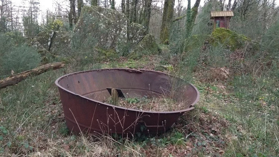
There are several charcoal burner’s kilns rusting in the forest.
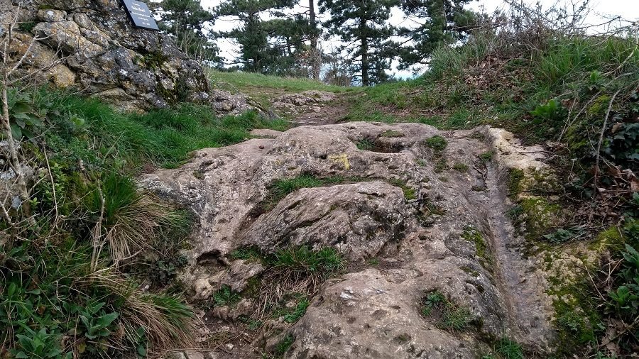
Spot the deep grooves worn by wheels over the millennia.
10.29 – It begins to rain. If I take a path on my left, I can shelter under a natural rock porch which, archaeologists have found, was used for similar purposes by my Neolithic ancestors. Instead, I press on and slither over a section of rock marked with deep grooves made by all the horse drawn carts that have passed this way over the millennia.
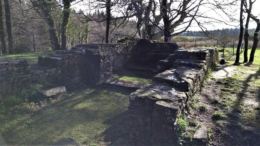
10.32 – I pick my way through the excavated ruins of the fortified village of Brunichellis, occupied between the 12th and 13th centuries.
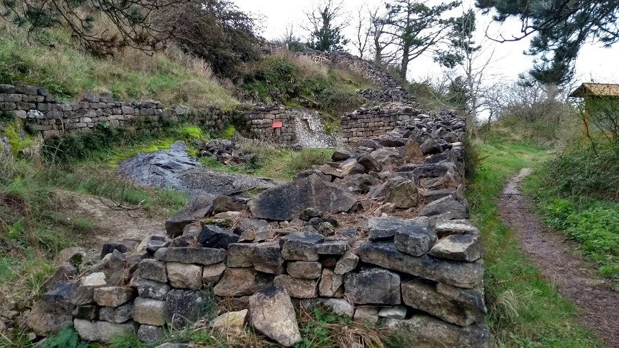
The ruins of the fortified village of Brunichellis.
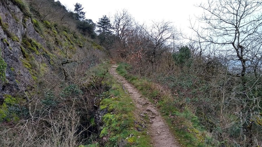
Iron Age defensive earthworks.
10.33 – On TV this morning, the meteorologists promised rain by ten o’clock. Now I can see it sweeping towards me across the plain of the Lauragais. I up my pace along the earthworks of a fort built by the Gauls before the Romans arrived.
10.45 – It starts to rain, but I am close enough to the finish line not to care, and within minutes I am back in the abbey’s car park.
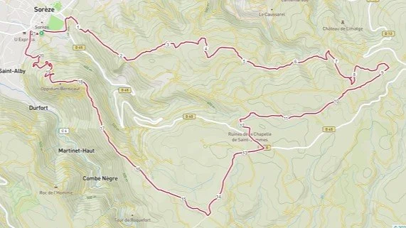
If you with to try something similar, here is the GPX file for the route.