Religious pearls of the Montagne Noire
The glorious abbeys of the Montagne Noire justifiably attract crowds of visitors, but there are other pearls hidden up higher in the mountain. Here, I will reveal four of them, far beyond the reach of tour buses, places where solitude is almost guaranteed if you manage to find them. So read on and discover a secret Protestant cemetery, a long-abandoned church and a bijou monastery reclaimed by the forest. But first, I shall take you to a rustic chapel which would be the perfect location for hobbits and wood elves if they were organising a wedding.
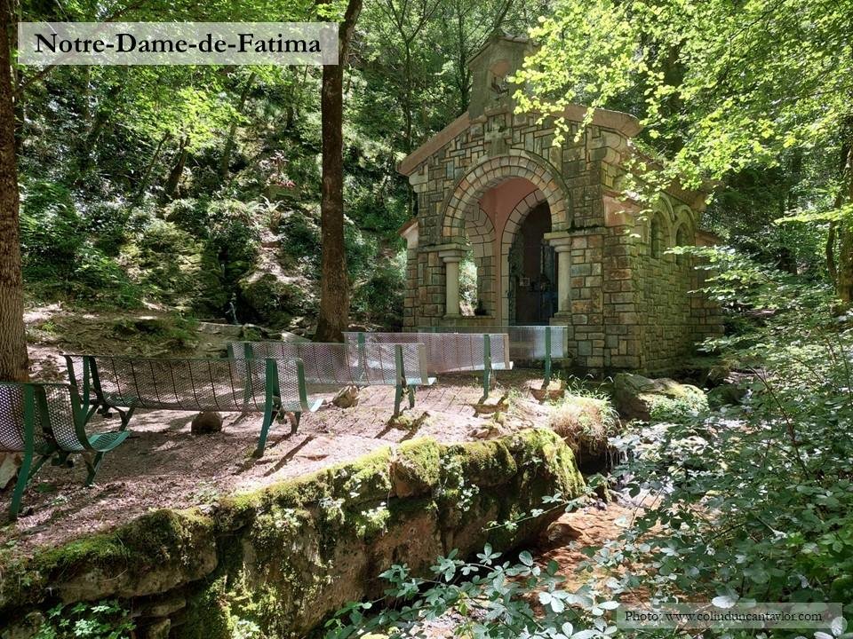
Hidden in the valley of the Baylou 2.5 kilometres south-west of Dourgne, this sylvan chapel has several names and legends. The current building was erected in the early 1950s to commemorate the homecoming of Dourgne’s youth after the second world war.
Long before then, a hermit called Saint Macaire lived here besides the sacred fountain of Mouniès. Supposedly its water has magical properties, and the villagers used to come here to cure various afflictions by dabbing themselves with a cloth dipped in the spring. For the treatment to work, the cloth had to left behind in the forest.
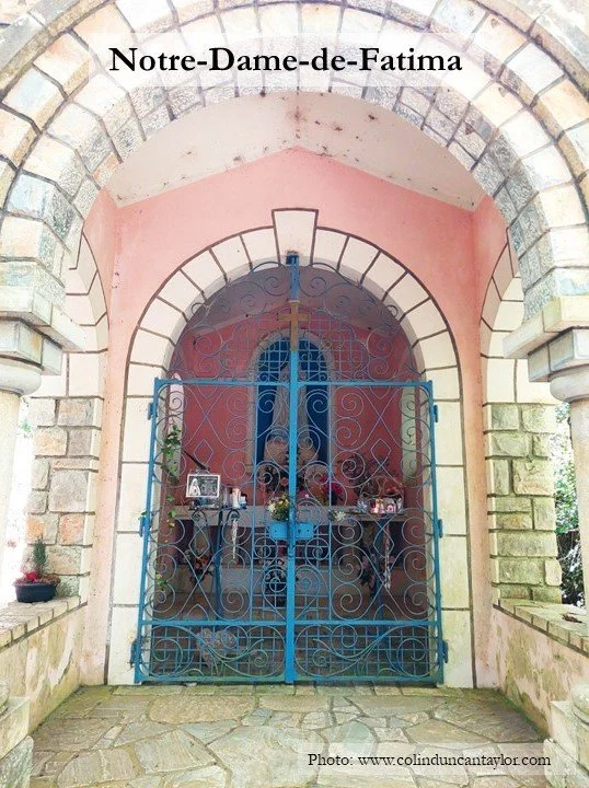
If you take a seat on one of the benches in the open-air nave and contemplate the chapel, soothed by the babbling brook and shaded by the forest, it is easy to understand why legends like this were born.
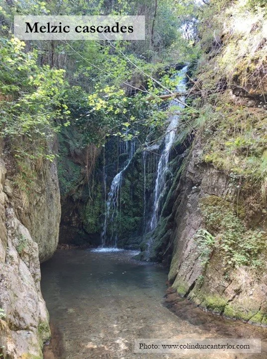
Follow the valley upstream, and another magical place awaits you where the Melzic cascades down a rockface into a pool – perfect for bathing on a hot day.
The Protestant cemetery of Grange Vielle
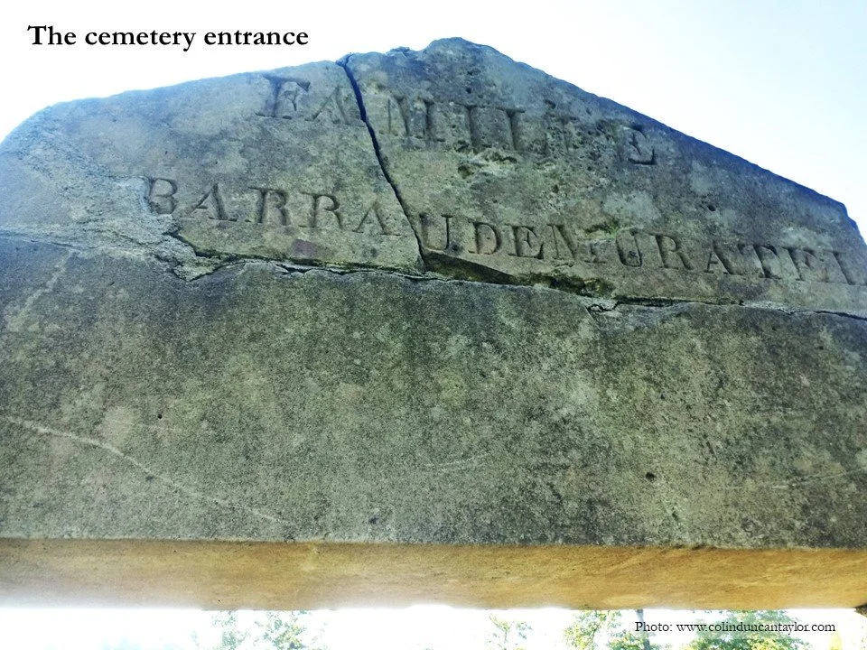
Literally lost in the forest above Sorèze, you will need GPS coordinates to have any hope of finding this place, so here they are: 43°25'55.9"N 2°07'44.9"E or 43.432193, 2.129138. The cemetery is clearly visible on Google Maps satellite view, but that image is not recent and trees grow quickly!
Long ago, the land in these parts belonged to the Benedictines, but during the Revolution it was bought by a Protestant nobleman called Cyr-Pierre de Barrau de Muratel. In the early 19th century, he built the Château de Grange Vieille on the north side of the road between Arfons and Sorèze, and created a family cemetery a few hundred metres away on the south side of the road. After the second world war, the Barrau de Muratels moved away and their cemetery was abandoned.
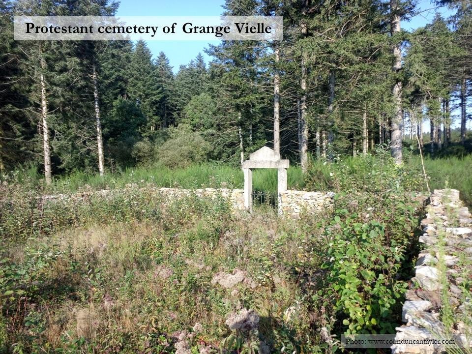
In 2016, a team from Sorèze cleared the site and restored some of the graves. Photos taken at that time show a walled cemetery with tidy tombs, but the forest is not beaten so easily. My photos which accompany this text were taken in September 2021, and I fear by now the site may be even more overgrown. If you pay a visit, you may like to follow my example and pack a scythe or some secateurs.
The Chapel of Saint-Jammes-de-Bezaucelle
Just over a kilometre to the west of the Protestant cemetery lie the ruins of a chapel, founded in the 12th century (or perhaps even earlier) and abandoned during the Revolution when it was part of the estate bought by Cyr-Pierre de Barrau de Muratel.
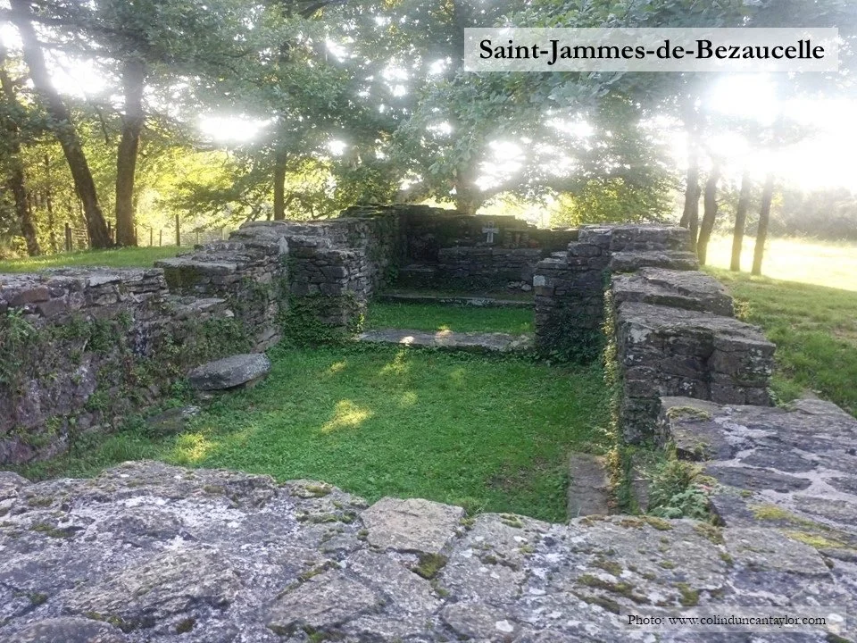
Its name and location suggest it may have had links with the Way of Saint James pilgrimage route to Santiago de Compostella. More certainly, it served as the parish church for isolated farming communities such as Grange Vielle.
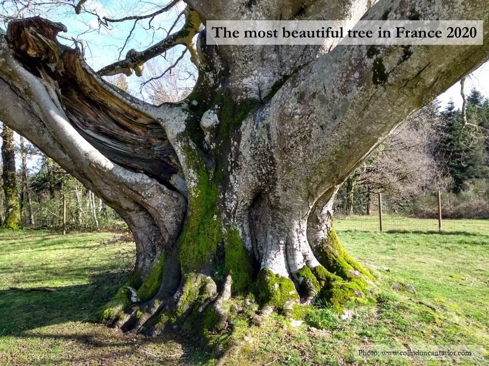
Beside the chapel stands a majestic beech tree, 450 years old. In 2020, this was voted the most beautiful tree in France.
The Chartreuse de La Loubatière
In 2020, I tried my hand at archaeology and helped the Société d’Histoire de Revel Saint-Ferréol excavate a small monastery founded by the Bishop of Carcassonne in 1315 or 1320.
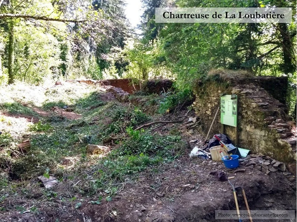
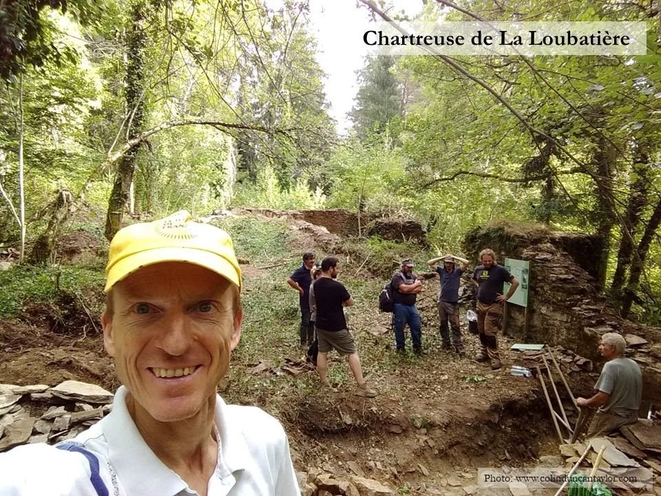
The abbey’s church was about 25 metres long and 7 metres wide with walls at least a metre thick, and my job was to excavate the north-east corner from several centuries of soil, roots and rubble.
It was too tough for the monks to eke out a living up here in the mountains, 20 kilometres north of Carcassonne, and La Loubatière was abandoned after little more than a century. I found it so tough, I gave up my archaeological struggles after a single day. Luckily there were plenty of other volunteers to continue the good work.