The mysterious object in the lake

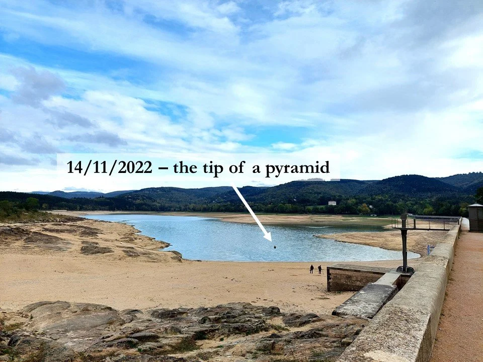
Yesterday, I cycled past the lake of Saint-Ferréol where three departments meet: Aude, Haute-Garonne and Tarn. Somewhere near their intersection I spotted an object peeping out of the water, something which has nothing to do with departmental boundaries, something which may mystify the casual visitor.
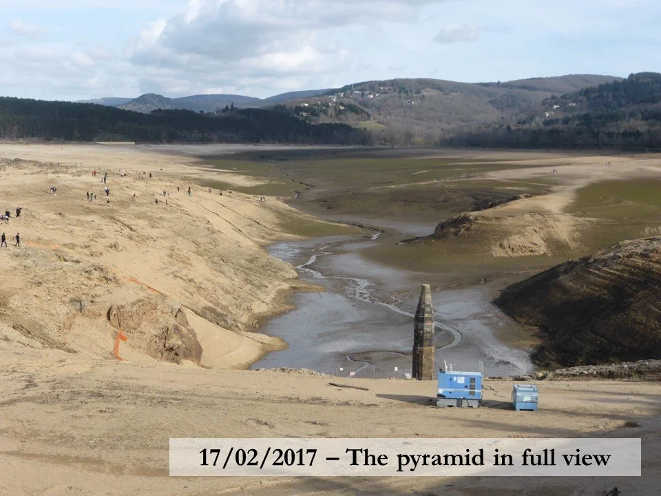
I last saw it when the lake was drained for maintenance during the winter of 2016-17. On that occasion, the object revealed its full height of 21 metres. For some inexplicable reason, local people call it ‘the pyramid’. To me, it looks more like a stubby pencil in need of sharpening.
The oldest dam in the France
Before I reveal its purpose, here are a few facts about Saint-Ferréol. The first stone of the dam was laid on Sunday 17 April 1667. When it was finished, it was the largest dam ever built. Today, it is the oldest dam in France. Its purpose was to supply water to the highest point of the Canal du Midi so that the locks could be kept full as boats went up and down the canal.
Vauban’s extension
Towards the end of the 17th century, the king’s great engineer, Sébastien Le Prestre de Vauban, decided the canal needed more water and he raised the dam wall by seven metres, thereby increasing the reservoir’s capacity by 50%.
Gauging the depths
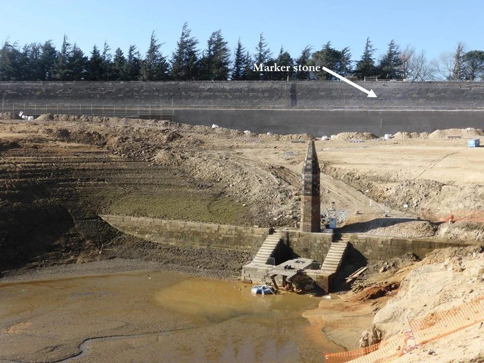
The pyramid, or unsharpened pencil, was erected on the upstream dam wall in 1770. Its tip is on the same level as the bottom of the main wall, so it is usually submerged and therefore useless because its true purpose is to gauge the depth of the lake at the glance of an eye. Five marker stones continue the scale up the main dam wall and provide a more useful means of measurement. All this was put in place thirty years before anyone started using the metric system, and the gradations are in fathoms and feet. The highest marker stone, just below the top of Vauban’s wall extension, is ninety-nine feet above the original stream bed.
This autumn, the pyramid’s appearance is testimony to an exceptionally long drought.